Show the map
OFFICIAL ROUTE
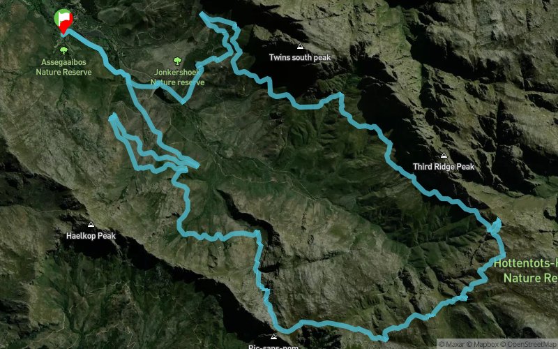
Jonkershoek Mountain Challenge 2017 - 38 km


 Stellenbosch (ZA)
The Jonkershoek Valley is without a doubt one of the most beautiful mountain scenes in the Western Cape. Massive turrets and cliffs of orange-faced quartzite hold fortress over a collection of rambling mountain streams and waterfalls. It's so magnificent that it's impossible to ignore, the essence of the place seeping under your skin into the fabric of your senses.
Points of Interest table
| Accum. | Intermediary | |||||||
|---|---|---|---|---|---|---|---|---|
| POI | Description | Alt. | Dist. | D+ | D- | Dist. | D+ | D- |
 Competition organized on 05/20/2017
Trace n°33601
Ascent threshold : 3 m Distance threshold : 30 m Smoothing : Yes Origin of altitudes : MNT Aster GDEM
Ascent threshold : 3 m Distance threshold : 30 m Smoothing : Yes Origin of altitudes : MNT Aster GDEM
Loop
Dominant terrain : Footpath
Max alti. : 1278 m
Avg alti. : 684 m
Min alti. : 214 m
Longest ascent : 730 m
Longest descent : 390 m
Dominant terrain : Footpath
Max alti. : 1278 m
Avg alti. : 684 m
Min alti. : 214 m
Longest ascent : 730 m
Longest descent : 390 m
Elevation profile
More tools
Create a new roadbook page
Map and track on your website
Warning ! When you insert a Trace de Trail map on your website, you agree not to hide any element of the module (links to Trail Trail or Trail Connect banner)
Add a realisation
Validate
Add a realisation to share your chrono and describe the conditions that you encountered during you trail running !
Add a comment
Validate
Show the infos
Add a track


