Show the map
La Diagonale Normande
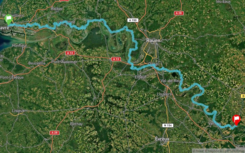


 Harfleur (76)
 La Roche-Guyon (95)
 Points of Interest table
| Accum. | Intermediary | |||||||
|---|---|---|---|---|---|---|---|---|
| POI | Description | Alt. | Dist. | D+ | D- | Dist. | D+ | D- |
Trace n°31687
Ascent threshold : 3 m Distance threshold : 0 m Smoothing : No Origin of altitudes : GPS
Ascent threshold : 3 m Distance threshold : 0 m Smoothing : No Origin of altitudes : GPS
Crossing
Dominant terrain : Footpath
Max alti. : 153 m
Avg alti. : 63 m
Min alti. : 2 m
Longest ascent : 160 m
Longest descent : 170 m
Route completed by the author : nc
Dominant terrain : Footpath
Max alti. : 153 m
Avg alti. : 63 m
Min alti. : 2 m
Longest ascent : 160 m
Longest descent : 170 m
Route completed by the author : nc
Elevation profile
More tools
Create a new roadbook page
Map and track on your website
Warning ! When you insert a Trace de Trail map on your website, you agree not to hide any element of the module (links to Trail Trail or Trail Connect banner)
Add a realisation
Validate
Add a realisation to share your chrono and describe the conditions that you encountered during you trail running !
Add a comment
Validate
Admin - Trace de Trail
05/12/17, 23:03:39
Bonjour, merci de renommer votre trace en suivant les règles de nommage du site avant de la placer en publique : https://tracedetrail.com/fr/accueil/help/alire
05/12/17, 23:03:39
Bonjour, merci de renommer votre trace en suivant les règles de nommage du site avant de la placer en publique : https://tracedetrail.com/fr/accueil/help/alire
Show the infos
Add a track


