Show the map
Trail du Pays de Grasse 2017 - 35 km
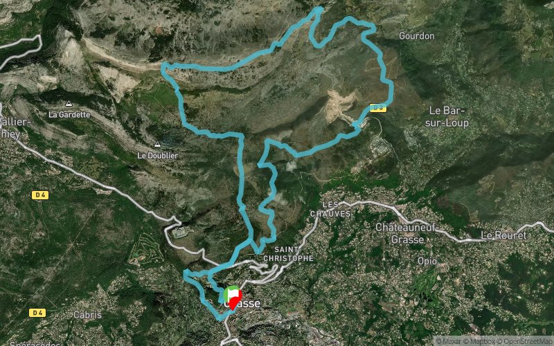


34.3 km
1590 m
1590 m
 Grasse (06)
 Points of Interest table
| Accum. | Intermediary | |||||||
|---|---|---|---|---|---|---|---|---|
| POI | Description | Alt. | Dist. | D+ | D- | Dist. | D+ | D- |
 Competition organized on 06/04/2017
Trace n°31389
Ascent threshold : 3 m Distance threshold : 30 m Smoothing : Yes Origin of altitudes : MNT Aster GDEM
Ascent threshold : 3 m Distance threshold : 30 m Smoothing : Yes Origin of altitudes : MNT Aster GDEM
Loop
Dominant terrain : Footpath
Max alti. : 1333 m
Avg alti. : 817 m
Min alti. : 335 m
Longest ascent : 1080 m
Longest descent : 770 m
Dominant terrain : Footpath
Max alti. : 1333 m
Avg alti. : 817 m
Min alti. : 335 m
Longest ascent : 1080 m
Longest descent : 770 m
Elevation profile
More tools
Create a new roadbook page
Map and track on your website
Warning ! When you insert a Trace de Trail map on your website, you agree not to hide any element of the module (links to Trail Trail or Trail Connect banner)
Add a realisation
Validate
Add a realisation to share your chrono and describe the conditions that you encountered during you trail running !
Add a comment
Validate
Admin - Trace de Trail
26/07/19, 09:08:14
Bonjour, Dans tous les cas vous pouvez télécharger l'appli mobile Trail Connect et retrouver ainsi tous les parcours de Trace de Trail.
26/07/19, 09:08:14
Bonjour, Dans tous les cas vous pouvez télécharger l'appli mobile Trail Connect et retrouver ainsi tous les parcours de Trace de Trail.
9190
25/07/19, 15:45:26
Bonjour, je serais à Grasse dans 2 jours. Ce sentier est il balisé? Cordialement, Gael
25/07/19, 15:45:26
Bonjour, je serais à Grasse dans 2 jours. Ce sentier est il balisé? Cordialement, Gael
Show the infos
Add a track


