Show the map
Certified Track - ITRA
Courchevel X-Trail 2017 - X-Trail 33 km
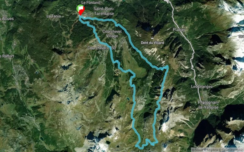


 Saint-Bon-Tarentaise (73)


Very nice race close to the Vanoise national park. 4 passes 2530 m.
full nature, no road. prize money 1000 €. start in the olympic jump stadium. panoramic track on montcharvet ridge
Points of Interest table
| Accum. | Intermediary | |||||||
|---|---|---|---|---|---|---|---|---|
| POI | Description | Alt. | Dist. | D+ | D- | Dist. | D+ | D- |
 Competition organized on 08/06/2017
Trace n°29039
Ascent threshold : 10 m Distance threshold : 0 m Smoothing : No Origin of altitudes : GPS
Ascent threshold : 10 m Distance threshold : 0 m Smoothing : No Origin of altitudes : GPS
Loop
Dominant terrain : Footpath
Max alti. : 2486 m
Avg alti. : 1894 m
Min alti. : 1214 m
Longest ascent : 410 m
Longest descent : 1260 m
Dominant terrain : Footpath
Max alti. : 2486 m
Avg alti. : 1894 m
Min alti. : 1214 m
Longest ascent : 410 m
Longest descent : 1260 m
Elevation profile
More tools
Create a new roadbook page
Map and track on your website
Warning ! When you insert a Trace de Trail map on your website, you agree not to hide any element of the module (links to Trail Trail or Trail Connect banner)
Add a realisation
Validate
Add a realisation to share your chrono and describe the conditions that you encountered during you trail running !
Add a comment
Validate
Show the infos
Add a track


