Show the map
Evaluated Track - ITRA
Ultra-Trail® Axarquia 2016 - Trail Axarquia
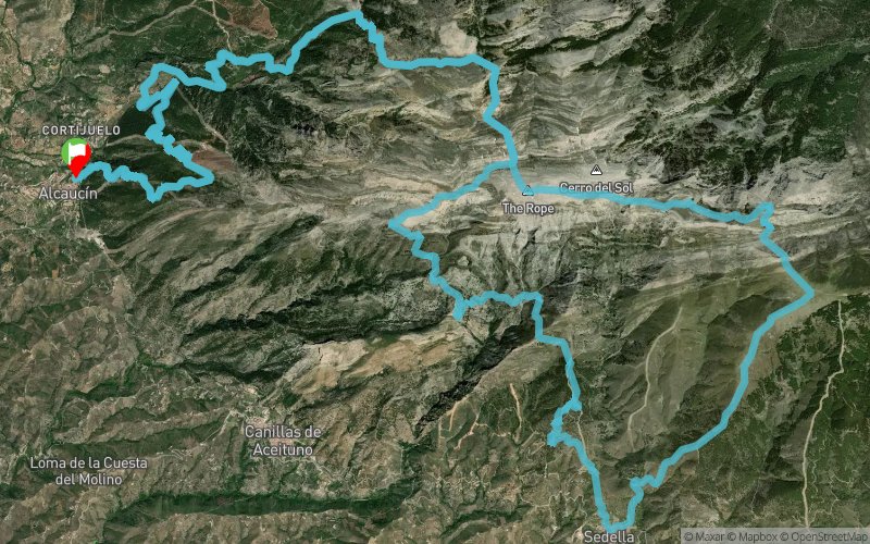


 Alcaucin (ES)


The Axarquia Trail, with 60 kilometers and a vertical drop of 7,200 meters accumulated, of which 3,655 meters are positive and 3,655 meters are negative. The Trail Axarquía Alcaucín pretends to be a reference in the calendar of any Trail runner, creating a test in an amazing place and with a route that will not leave you indifferent.
Points of Interest table
| Accum. | Intermediary | |||||||
|---|---|---|---|---|---|---|---|---|
| POI | Description | Alt. | Dist. | D+ | D- | Dist. | D+ | D- |
 Competition organized on 11/05/2016
Trace n°28555
Ascent threshold : 3 m Distance threshold : 30 m Smoothing : Yes Origin of altitudes : MNT Aster GDEM
Ascent threshold : 3 m Distance threshold : 30 m Smoothing : Yes Origin of altitudes : MNT Aster GDEM
Loop
Dominant terrain : Footpath
Max alti. : 2066 m
Avg alti. : 1215 m
Min alti. : 533 m
Longest ascent : 1360 m
Longest descent : 1490 m
Dominant terrain : Footpath
Max alti. : 2066 m
Avg alti. : 1215 m
Min alti. : 533 m
Longest ascent : 1360 m
Longest descent : 1490 m
Elevation profile
More tools
Create a new roadbook page
Map and track on your website
Warning ! When you insert a Trace de Trail map on your website, you agree not to hide any element of the module (links to Trail Trail or Trail Connect banner)
Add a realisation
Validate
Add a realisation to share your chrono and describe the conditions that you encountered during you trail running !
Add a comment
Validate
Show the infos
Add a track


