Show the map
Étabg d'Haspelschiedt - Roppeviller - Altschlossfelsen
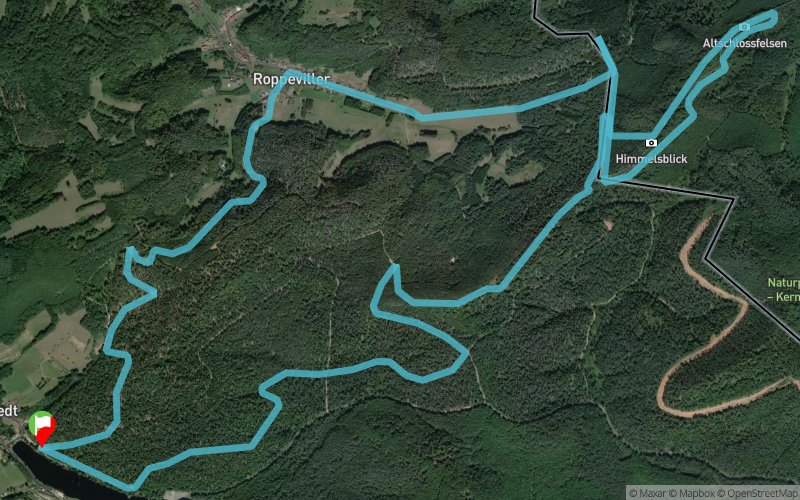


13.3 km
370 m
370 m
 Haspelschiedt (57)
 Points of Interest table
| Accum. | Intermediary | |||||||
|---|---|---|---|---|---|---|---|---|
| POI | Description | Alt. | Dist. | D+ | D- | Dist. | D+ | D- |
Trace n°27578
Ascent threshold : 3 m Distance threshold : 30 m Smoothing : Yes Origin of altitudes : MNT Aster GDEM
Ascent threshold : 3 m Distance threshold : 30 m Smoothing : Yes Origin of altitudes : MNT Aster GDEM
Loop
Dominant terrain : Footpath
Max alti. : 400 m
Avg alti. : 335 m
Min alti. : 268 m
Longest ascent : 70 m
Longest descent : 110 m
Route completed by the author : nc
Dominant terrain : Footpath
Max alti. : 400 m
Avg alti. : 335 m
Min alti. : 268 m
Longest ascent : 70 m
Longest descent : 110 m
Route completed by the author : nc
Elevation profile
More tools
Create a new roadbook page
Map and track on your website
Warning ! When you insert a Trace de Trail map on your website, you agree not to hide any element of the module (links to Trail Trail or Trail Connect banner)
Add a realisation
Validate
Add a realisation to share your chrono and describe the conditions that you encountered during you trail running !
Add a comment
Validate
FFRA
09/03/24, 01:55:25
La section 8 - 9 - 10 - 11 - 12 - 13 traverse le Camp Militaire de Bitche. Il y a un panneau d'interdiction au niveau de l'étiquette 8.
09/03/24, 01:55:25
La section 8 - 9 - 10 - 11 - 12 - 13 traverse le Camp Militaire de Bitche. Il y a un panneau d'interdiction au niveau de l'étiquette 8.
Show the infos
Add a track


