Show the map
trail de montaigu 37 km
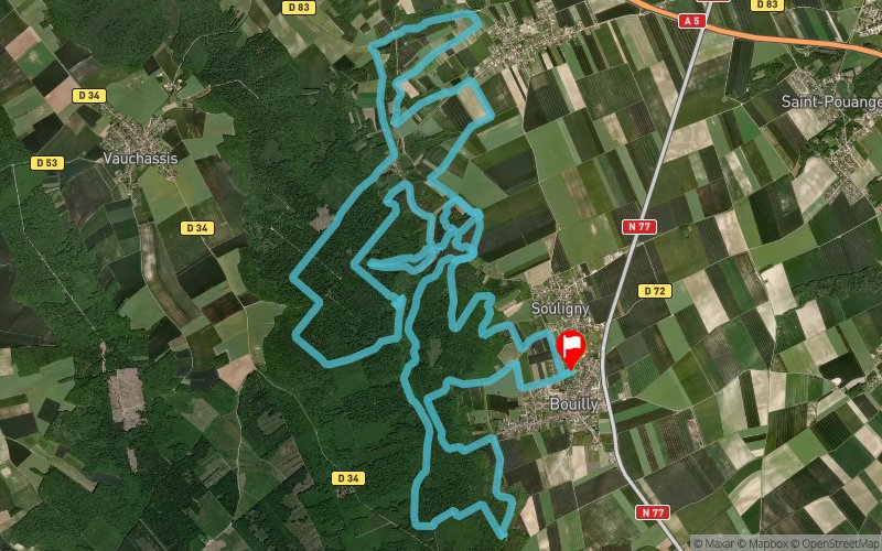


36.7 km
1027 m
1036 m
 Bouilly (10)
 Bouilly (10)
 Points of Interest table
| Accum. | Intermediary | |||||||
|---|---|---|---|---|---|---|---|---|
| POI | Description | Alt. | Dist. | D+ | D- | Dist. | D+ | D- |
 Competition organized on 04/20/2014
Trace n°2433
Ascent threshold : 0 m Distance threshold : 35 m Smoothing : Yes Origin of altitudes : MNT Aster GDEM
Ascent threshold : 0 m Distance threshold : 35 m Smoothing : Yes Origin of altitudes : MNT Aster GDEM
Loop
Dominant terrain : Footpath
Max alti. : 284 m
Avg alti. : 224 m
Min alti. : 147 m
Longest ascent : 139 m
Longest descent : 113 m
Dominant terrain : Footpath
Max alti. : 284 m
Avg alti. : 224 m
Min alti. : 147 m
Longest ascent : 139 m
Longest descent : 113 m
Elevation profile
More tools
Create a new roadbook page
Map and track on your website
Warning ! When you insert a Trace de Trail map on your website, you agree not to hide any element of the module (links to Trail Trail or Trail Connect banner)
Add a realisation
Validate
Add a realisation to share your chrono and describe the conditions that you encountered during you trail running !
Add a comment
Validate
Xtino10
09/06/15, 16:54:07
Cette trace m'interesse,j'ai couru la version 21km cette année du trail de Montaigu,je devrais me mettre sur la version 42km cette année,donc je vais tester cette version des années précédente dans les mois qui viennent... Merci Runninblack!!!
09/06/15, 16:54:07
Cette trace m'interesse,j'ai couru la version 21km cette année du trail de Montaigu,je devrais me mettre sur la version 42km cette année,donc je vais tester cette version des années précédente dans les mois qui viennent... Merci Runninblack!!!
Show the infos
Add a track


