Show the map
Col de Crie - Mont Saint Rigaud - Montagne de Theyssonnière
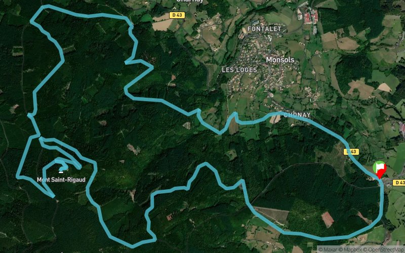


18.8 km
680 m
690 m
 Monsols (69)
 Points of Interest table
| Accum. | Intermediary | |||||||
|---|---|---|---|---|---|---|---|---|
| POI | Description | Alt. | Dist. | D+ | D- | Dist. | D+ | D- |
Trace n°23333
Ascent threshold : 3 m Distance threshold : 30 m Smoothing : Yes Origin of altitudes : MNT Aster GDEM
Ascent threshold : 3 m Distance threshold : 30 m Smoothing : Yes Origin of altitudes : MNT Aster GDEM
Loop
Dominant terrain : Path
Max alti. : 997 m
Avg alti. : 772 m
Min alti. : 571 m
Longest ascent : 210 m
Longest descent : 280 m
Route completed by the author : nc
Dominant terrain : Path
Max alti. : 997 m
Avg alti. : 772 m
Min alti. : 571 m
Longest ascent : 210 m
Longest descent : 280 m
Route completed by the author : nc
Elevation profile
More tools
Create a new roadbook page
Map and track on your website
Warning ! When you insert a Trace de Trail map on your website, you agree not to hide any element of the module (links to Trail Trail or Trail Connect banner)
Add a realisation
Validate
Add a realisation to share your chrono and describe the conditions that you encountered during you trail running !
Add a comment
Validate
Fredo
20/08/19, 09:12:39
C’est un peu la Barkley par moment... des chemins qui n’existent plus... bonjour les ronces ! Il vaut mieux suivre les chemins officiels de la station de Trail.
20/08/19, 09:12:39
C’est un peu la Barkley par moment... des chemins qui n’existent plus... bonjour les ronces ! Il vaut mieux suivre les chemins officiels de la station de Trail.
Show the infos
Add a track


