Show the map
Certified Track - ITRA
P10_l'esprit du tanargue
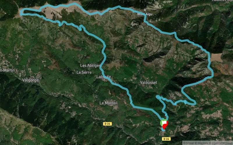


 Champussac (07)


Points of Interest table
| Accum. | Intermediary | |||||||
|---|---|---|---|---|---|---|---|---|
| POI | Description | Alt. | Dist. | D+ | D- | Dist. | D+ | D- |
Trace n°2312
Ascent threshold : 0 m Distance threshold : 35 m Smoothing : Yes Origin of altitudes : MNT Aster GDEM
Ascent threshold : 0 m Distance threshold : 35 m Smoothing : Yes Origin of altitudes : MNT Aster GDEM
Loop
Dominant terrain : Footpath
Max alti. : 1451 m
Avg alti. : 962 m
Min alti. : 453 m
Longest ascent : 856 m
Longest descent : 821 m
Route completed by the author : nc
Dominant terrain : Footpath
Max alti. : 1451 m
Avg alti. : 962 m
Min alti. : 453 m
Longest ascent : 856 m
Longest descent : 821 m
Route completed by the author : nc
Elevation profile
More tools
Create a new roadbook page
Map and track on your website
Warning ! When you insert a Trace de Trail map on your website, you agree not to hide any element of the module (links to Trail Trail or Trail Connect banner)
Add a realisation
Validate
Add a realisation to share your chrono and describe the conditions that you encountered during you trail running !
Add a comment
Validate
Miglezard26
28/04/16, 22:01:04
Pour la rando c'est super pour le trail c'est nul! Par contre les paysages sont vraiment magnifique.
28/04/16, 22:01:04
Pour la rando c'est super pour le trail c'est nul! Par contre les paysages sont vraiment magnifique.
Show the infos
Add a track


