Show the map
Gent trail 2023 - 7km
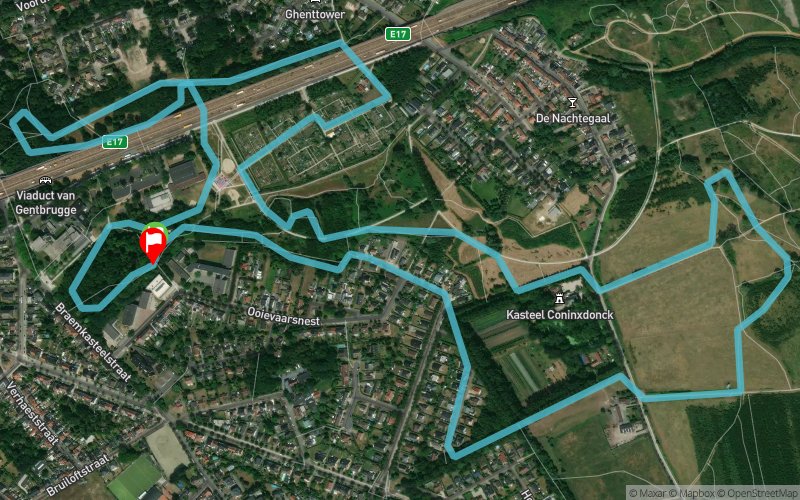


5.9 km
70 m
70 m
 Grootoorvleermuispad (naast lagere school GO Hazenakker), 9050 Gentbrugge (BE)
 Grootoorvleermuispad (naast lagere school GO Hazenakker), 9050 Gentbrugge (BE)
 Points of Interest table
| Accum. | Intermediary | |||||||
|---|---|---|---|---|---|---|---|---|
| POI | Description | Alt. | Dist. | D+ | D- | Dist. | D+ | D- |
 Event off organized on 03/05/2023
Trace n°208748
Ascent threshold : 3 m Distance threshold : 30 m Smoothing : Yes Origin of altitudes : MNT Aster GDEM
Ascent threshold : 3 m Distance threshold : 30 m Smoothing : Yes Origin of altitudes : MNT Aster GDEM
Loop
Dominant terrain : Footpath
Max alti. : 23 m
Avg alti. : 8 m
Min alti. : 4 m
Longest ascent : 60 m
Longest descent : 20 m
Dominant terrain : Footpath
Max alti. : 23 m
Avg alti. : 8 m
Min alti. : 4 m
Longest ascent : 60 m
Longest descent : 20 m
Elevation profile
More tools
Create a new roadbook page
Map and track on your website
Warning ! When you insert a Trace de Trail map on your website, you agree not to hide any element of the module (links to Trail Trail or Trail Connect banner)
Add a realisation
Validate
Add a realisation to share your chrono and describe the conditions that you encountered during you trail running !
Add a comment
Validate
Show the infos
Add a track


