
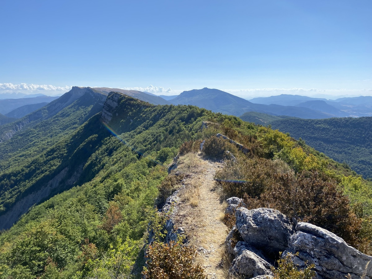
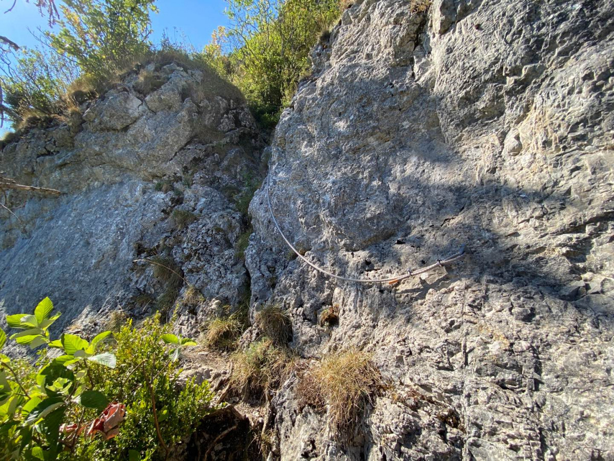
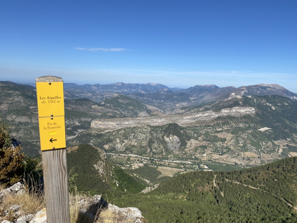
Vertiginous itinerary for those who prefers more difficult trails and 360° panoramas. More than 800 meters of elevation gain in less than 5 km and it will still be necessary to climb through the the mountain with wired passages, equipped with handrails, to reach the top of the mountain Aiguilles. You will then have 2 km of ridges, sometimes aerial, to then enjoy the view of the surrounding mountains. A more technical descent, with a beautiful section off the beaten track, a detour by the Montrond for a glimpse of horizon, and you will continue to descend towards the village on a track that varies along the way, taking sinuous forest paths…
The areas you are about to take cross a Natura 2000 area, known for its remarkable biodiversity. You too, participate in its preservation by adopting an eco-responsible attitude. This pathwill allow you to engage on the crest of the Montagne des Gravières, where you will appreciate the remarkable biogeographic contrasts of the Baronnies provençales. The northern slopes are covered with a cool and shaded forest of beech and fir, where the Black Woodpecker or Tengmalm’s Owl can be heard. On the opposite side, the southern slopes and ridges are here covered with dry lawns, covered with vulgar Thyme and true Lavender, where live more Mediterranean birds such as the Orpheus warbler.

- Distance 19.7 km
- Elevation gain 1290 m
- Elevation lost 1290 m
- Min. elevation 448 m
- Max. elevation. 1353 m
- Duration (depending on pace) 3h à 6h30
- Marking n°10 black


the digital trails


![]()

