Show the map
Les Vignes de Chaumont - Bois de Ligugé - Chantejau
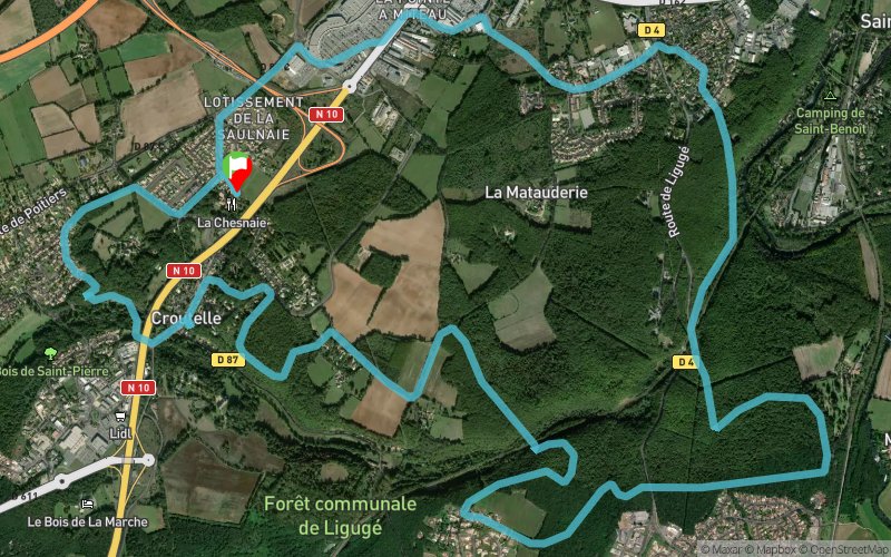


16.9 km
300 m
310 m
 Croutelle (86)
 Points of Interest table
| Accum. | Intermediary | |||||||
|---|---|---|---|---|---|---|---|---|
| POI | Description | Alt. | Dist. | D+ | D- | Dist. | D+ | D- |
Trace n°18331
Ascent threshold : 3 m Distance threshold : 30 m Smoothing : Yes Origin of altitudes : MNT Aster GDEM
Ascent threshold : 3 m Distance threshold : 30 m Smoothing : Yes Origin of altitudes : MNT Aster GDEM
Loop
Dominant terrain : Footpath
Max alti. : 149 m
Avg alti. : 126 m
Min alti. : 88 m
Longest ascent : 70 m
Longest descent : 70 m
Route completed by the author : nc
Dominant terrain : Footpath
Max alti. : 149 m
Avg alti. : 126 m
Min alti. : 88 m
Longest ascent : 70 m
Longest descent : 70 m
Route completed by the author : nc
Elevation profile
More tools
Create a new roadbook page
Map and track on your website
Warning ! When you insert a Trace de Trail map on your website, you agree not to hide any element of the module (links to Trail Trail or Trail Connect banner)
Add a realisation
Validate
Add a realisation to share your chrono and describe the conditions that you encountered during you trail running !
Add a comment
Validate
Bert29
20/02/16, 17:56:14
Boucle réalisée en nocturne, à la frontale. Cette trace évite les bas de la Boivre et du Clain qui sont en crue à cette saison, en particulier le dessous du bois de Givray qui jouxte St Benoit.
20/02/16, 17:56:14
Boucle réalisée en nocturne, à la frontale. Cette trace évite les bas de la Boivre et du Clain qui sont en crue à cette saison, en particulier le dessous du bois de Givray qui jouxte St Benoit.
Show the infos
Add a track


