Show the map
OFFICIAL ROUTE
Crossing Switzerland 2022
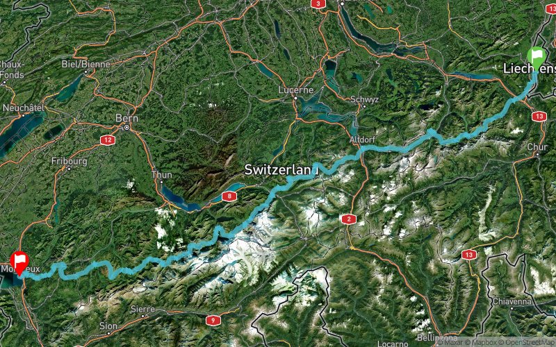


394 km
23050 m
23130 m
 Vaduz (LI)
 Montreux (CH)
 Points of Interest table
| Accum. | Intermediary | |||||||
|---|---|---|---|---|---|---|---|---|
| POI | Description | Alt. | Dist. | D+ | D- | Dist. | D+ | D- |
 Competition organized on 07/23/2022
Trace n°167009
Ascent threshold : 3 m Distance threshold : 0 m Smoothing : No Origin of altitudes : GPS
Ascent threshold : 3 m Distance threshold : 0 m Smoothing : No Origin of altitudes : GPS
Crossing
Dominant terrain : Footpath
Max alti. : 2778 m
Avg alti. : 1509 m
Min alti. : 373 m
Longest ascent : 2090 m
Longest descent : 1730 m
Dominant terrain : Footpath
Max alti. : 2778 m
Avg alti. : 1509 m
Min alti. : 373 m
Longest ascent : 2090 m
Longest descent : 1730 m
More tools
Create a new roadbook page
Map and track on your website
Warning ! When you insert a Trace de Trail map on your website, you agree not to hide any element of the module (links to Trail Trail or Trail Connect banner)
Add a realisation
Validate
Add a realisation to share your chrono and describe the conditions that you encountered during you trail running !
Add a comment
Validate
Show the infos
Add a track


