Show the map
Certified Track - ITRA
Entrecortijos 2015 - EC 26


 Llanos De Parra (ES)


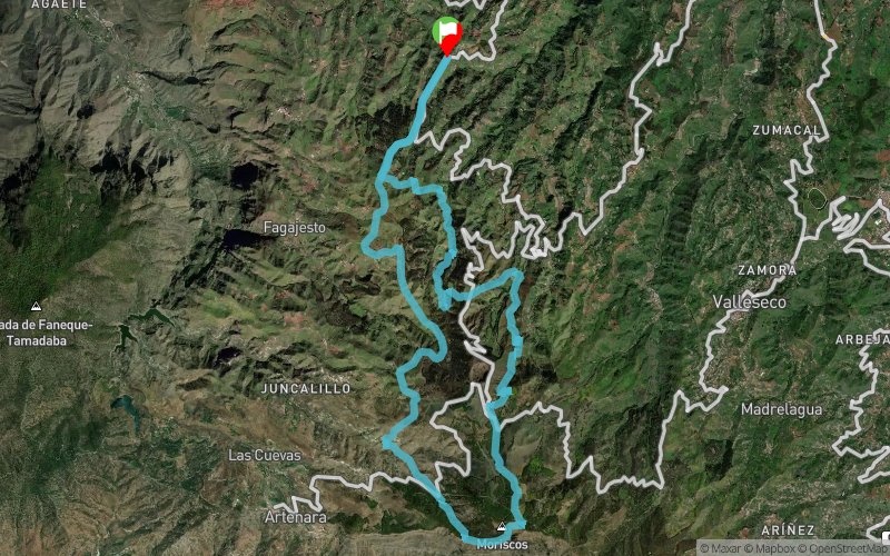
Round race that begins and ends in Montaña Alta, in the town of Santa María de Guía. It runs though spectaculars locations on the midlands of Gran Canaria, surrounding by farmhouses, cultivations lands and fields.
The category EC26 is included in Copa de Canarias. A trailrunning circuit set up over the six most prestigious race of the islands. This competition is organized under the Canarian Mountain´s Federation. And is also binding for the Trail Series. The reference race circuit in Gran Canaria where the trailrunner can discover the island though the most importants races.
Points of Interest table
| Accum. | Intermediary | |||||||
|---|---|---|---|---|---|---|---|---|
| POI | Description | Alt. | Dist. | D+ | D- | Dist. | D+ | D- |
 Competition organized on 04/25/2015
Trace n°14733
Ascent threshold : 10 m Distance threshold : 0 m Smoothing : No Origin of altitudes : GPS
Ascent threshold : 10 m Distance threshold : 0 m Smoothing : No Origin of altitudes : GPS
Loop
Dominant terrain : Footpath
Max alti. : 1737 m
Avg alti. : 1236 m
Min alti. : 865 m
Longest ascent : 600 m
Longest descent : 690 m
Dominant terrain : Footpath
Max alti. : 1737 m
Avg alti. : 1236 m
Min alti. : 865 m
Longest ascent : 600 m
Longest descent : 690 m
Elevation profile
More tools
Create a new roadbook page
Map and track on your website
Warning ! When you insert a Trace de Trail map on your website, you agree not to hide any element of the module (links to Trail Trail or Trail Connect banner)
Add a realisation
Validate
Add a realisation to share your chrono and describe the conditions that you encountered during you trail running !
Add a comment
Validate
Show the infos
Add a track


