Show the map
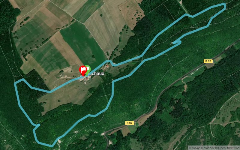
24 Heures de Suchaux 2021 - 6 km


 Lods (25)
 Lods (25)
 Points of Interest table
| Accum. | Intermediary | |||||||
|---|---|---|---|---|---|---|---|---|
| POI | Description | Alt. | Dist. | D+ | D- | Dist. | D+ | D- |
 Competition organized on 07/24/2021
Trace n°142251
Ascent threshold : 3 m Distance threshold : 30 m Smoothing : Yes Origin of altitudes : MNT Aster GDEM
Ascent threshold : 3 m Distance threshold : 30 m Smoothing : Yes Origin of altitudes : MNT Aster GDEM
Loop
Dominant terrain : Path
Max alti. : 742 m
Avg alti. : 674 m
Min alti. : 549 m
Longest ascent : 200 m
Longest descent : 100 m
Dominant terrain : Path
Max alti. : 742 m
Avg alti. : 674 m
Min alti. : 549 m
Longest ascent : 200 m
Longest descent : 100 m
Elevation profile
More tools
Create a new roadbook page
Map and track on your website
Warning ! When you insert a Trace de Trail map on your website, you agree not to hide any element of the module (links to Trail Trail or Trail Connect banner)
Add a realisation
Validate
Add a realisation to share your chrono and describe the conditions that you encountered during you trail running !
Add a comment
Validate
PatDUBOZ
13/12/21, 10:50:53
Circuit interdit du 1 er septembre au 1er Mars, des propriétés privées sont traversées
13/12/21, 10:50:53
Circuit interdit du 1 er septembre au 1er Mars, des propriétés privées sont traversées
Show the infos
Add a track


