Show the map
Offon Maxicross
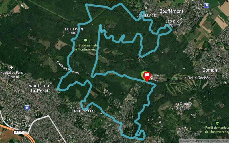


26 km
1170 m
1170 m
 Andilly (95)
 Andilly (95)
 Points of Interest table
| Accum. | Intermediary | |||||||
|---|---|---|---|---|---|---|---|---|
| POI | Description | Alt. | Dist. | D+ | D- | Dist. | D+ | D- |
Trace n°139682
Ascent threshold : 2 m Distance threshold : 30 m Smoothing : Yes Origin of altitudes : MNT Aster GDEM
Ascent threshold : 2 m Distance threshold : 30 m Smoothing : Yes Origin of altitudes : MNT Aster GDEM
Loop
Dominant terrain : Footpath
Max alti. : 210 m
Avg alti. : 162 m
Min alti. : 64 m
Longest ascent : 120 m
Longest descent : 120 m
Route completed by the author : Yes
Dominant terrain : Footpath
Max alti. : 210 m
Avg alti. : 162 m
Min alti. : 64 m
Longest ascent : 120 m
Longest descent : 120 m
Route completed by the author : Yes
Elevation profile
More tools
Create a new roadbook page
Map and track on your website
Warning ! When you insert a Trace de Trail map on your website, you agree not to hide any element of the module (links to Trail Trail or Trail Connect banner)
Add a realisation
Validate
Add a realisation to share your chrono and describe the conditions that you encountered during you trail running !
Add a comment
Validate
Show the infos
MODERATION
Merci de respecter les règles de nommage du site
Please respect the naming rules of the site
Merci de respecter les règles de nommage du site
Please respect the naming rules of the site
Add a track


