Show the map
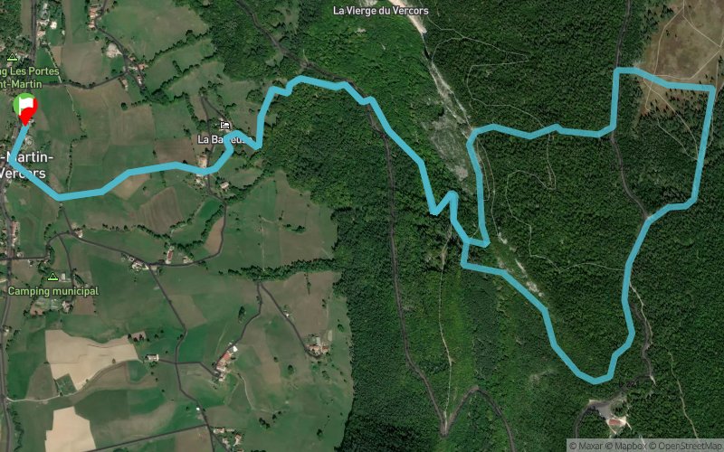
Rando 16 - AMM- Prairie d'Herbouly


9.5 km
705 m
705 m

Points of Interest table
Accum. | Intermediary | |||||||
---|---|---|---|---|---|---|---|---|
POI | Description | Alt. | Dist. | D+ | D- | Dist. | D+ | D- |
Trace n°1361
Ascent threshold : 0 m Distance threshold : 35 m Smoothing : Yes Origin of altitudes : MNT Aster GDEM
Loop
Dominant terrain : Footpath
Max alti. : 1325 m
Avg alti. : 1045 m
Min alti. : 718 m
Longest ascent : 684 m
Longest descent : 596 m
Route completed by the author : nc
Dominant terrain : Footpath
Max alti. : 1325 m
Avg alti. : 1045 m
Min alti. : 718 m
Longest ascent : 684 m
Longest descent : 596 m
Route completed by the author : nc
Elevation profile

Their last tracks
Le Platé - Diélette - Flamanville - Ertot - La Lande des Pieux
16.1 km
340 m
330 m
Siouville-Hague (50)
More tools
Create a new roadbook page
Carte à la Carte IGN
Map and track on your website
Warning ! When you insert a Trace de Trail map on your website, you agree not to hide any element of the module (links to Trail Trail or Trail Connect banner)
Add a realisation
Validate
Add a realisation to share your chrono and describe the conditions that you encountered during you trail running !
Add a comment
Validate
Nearby tracks
1.6 km Les Morands - Les Domarières - Rochers du Bournillon - Pas de l'Allier
9.6 km
380 m
380 m
Saint-Martin-en-Vercors (26)
6.6 km Les Saffrières - Pas de l'Allier - Les Grands Goulets - Les Barques en Vercors
20.1 km
1760 m
1760 m
Échevis (26)
8.1 km Malaterre - Herbouilly - Col de la Sarna - Bois de Carrette
26.3 km
730 m
730 m
Corrençon-en-Vercors (38)
8.2 km Le Bruchet - Col de Sarna - Baraque de Pré Rateau - Canyon des Erges - Darbounouse
59.8 km
1840 m
1840 m
Corrençon-en-Vercors (38)
8.2 km Cabane de Carrette - Canyon des Erges - Plaine de la Chau - Pré Peyret - Montagne de Beurre
36.3 km
1330 m
1100 m
Corrençon-en-Vercors (38)
8.2 km La Croix de la Messe - Bois de Carrette - Fleur du Roy
16.8 km
480 m
490 m
Corrençon-en-Vercors (38)
8.2 km GR91 - Partie 2 - Corrençon - Châtillon en Diois
50.8 km
1677 m
2211 m
Corrençon-en-Vercors (38)
8.2 km Les Trois Fontaines - La Croix de la Messe - Darbounouse
16.9 km
497 m
494 m
Corrençon-en-Vercors (38)
8.3 km Clot de la Balme - Grande Moucherolle - Roybon
17.1 km
1440 m
1160 m
Corrençon-en-Vercors (38)
8.3 km Darbounous - Montagne du Glandasse - Cab. de Châtillon
48.6 km
1520 m
2080 m
Corrençon-en-Vercors (38)
Show the infos
Add a track