Show the map
Evaluated Track - ITRA
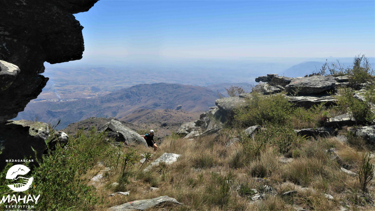
Ultramad Madagascar 2021 - 39 km - Stage 1


 Unknown (ND)
 Unknown (ND)

Intermediate mountain stage between two different and opposite massifs. The
Manandona starts the day by offering «rolling» singles before a steep descent into the valley in the middle of the rice fields. Then, the Ibity massif, more mineral, makes you enter the heart of the subject with technical trails and a passage at 2200m before starting the descent a little technical.
Points of Interest table
| Accum. | Intermediary | |||||||
|---|---|---|---|---|---|---|---|---|
| POI | Description | Alt. | Dist. | D+ | D- | Dist. | D+ | D- |
 Competition organized on 09/05/2021
Trace n°124453
Ascent threshold : 3 m Distance threshold : 30 m Smoothing : Yes Origin of altitudes : MNT Google
Ascent threshold : 3 m Distance threshold : 30 m Smoothing : Yes Origin of altitudes : MNT Google
Loop
Dominant terrain : Path
Max alti. : 2191 m
Avg alti. : 1582 m
Min alti. : 1348 m
Longest ascent : 850 m
Longest descent : 1060 m
Dominant terrain : Path
Max alti. : 2191 m
Avg alti. : 1582 m
Min alti. : 1348 m
Longest ascent : 850 m
Longest descent : 1060 m
Elevation profile
More tools
Create a new roadbook page
Map and track on your website
Warning ! When you insert a Trace de Trail map on your website, you agree not to hide any element of the module (links to Trail Trail or Trail Connect banner)
Add a realisation
Validate
Add a realisation to share your chrono and describe the conditions that you encountered during you trail running !
Add a comment
Validate
Show the infos
Add a track


