Show the map
Rothlach
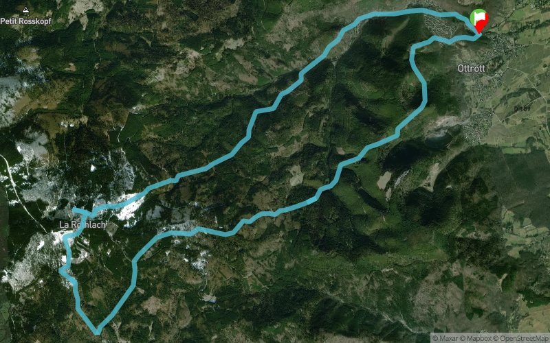


26.8 km
1420 m
1420 m
 Ottrott (67)
 Points of Interest table
| Accum. | Intermediary | |||||||
|---|---|---|---|---|---|---|---|---|
| POI | Description | Alt. | Dist. | D+ | D- | Dist. | D+ | D- |
Trace n°117207
Ascent threshold : 3 m Distance threshold : 30 m Smoothing : Yes Origin of altitudes : MNT Aster GDEM
Ascent threshold : 3 m Distance threshold : 30 m Smoothing : Yes Origin of altitudes : MNT Aster GDEM
Loop
Dominant terrain : Footpath
Max alti. : 992 m
Avg alti. : 618 m
Min alti. : 249 m
Longest ascent : 660 m
Longest descent : 470 m
Route completed by the author : No
Dominant terrain : Footpath
Max alti. : 992 m
Avg alti. : 618 m
Min alti. : 249 m
Longest ascent : 660 m
Longest descent : 470 m
Route completed by the author : No
Elevation profile
More tools
Create a new roadbook page
Map and track on your website
Warning ! When you insert a Trace de Trail map on your website, you agree not to hide any element of the module (links to Trail Trail or Trail Connect banner)
Add a realisation
Validate
Add a realisation to share your chrono and describe the conditions that you encountered during you trail running !
Add a comment
Validate
Djay
02/08/20, 15:35:24
Trace inexploitable, déjà le départ est sur une propriété privée , est aucune des traces( en tout cas sur les premiers km n’existe
02/08/20, 15:35:24
Trace inexploitable, déjà le départ est sur une propriété privée , est aucune des traces( en tout cas sur les premiers km n’existe
Show the infos
Add a track


