Show the map
Col de Tourniol - Pas du Touët
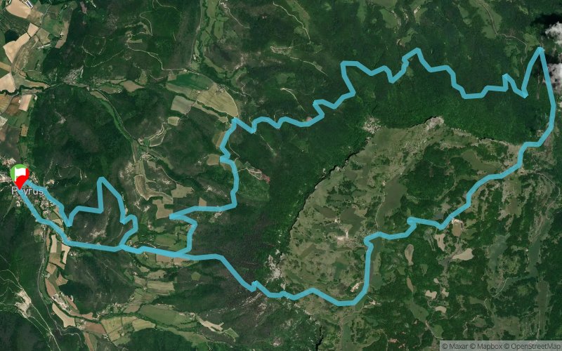


22.6 km
1353 m
1357 m
 Peyrus (26)
 Points of Interest table
| Accum. | Intermediary | |||||||
|---|---|---|---|---|---|---|---|---|
| POI | Description | Alt. | Dist. | D+ | D- | Dist. | D+ | D- |
Trace n°11557
Ascent threshold : 3 m Distance threshold : 30 m Smoothing : Yes Origin of altitudes : MNT Aster GDEM
Ascent threshold : 3 m Distance threshold : 30 m Smoothing : Yes Origin of altitudes : MNT Aster GDEM
Loop
Dominant terrain : Footpath
Max alti. : 1199 m
Avg alti. : 755 m
Min alti. : 385 m
Longest ascent : 305 m
Longest descent : 589 m
Route completed by the author : nc
Dominant terrain : Footpath
Max alti. : 1199 m
Avg alti. : 755 m
Min alti. : 385 m
Longest ascent : 305 m
Longest descent : 589 m
Route completed by the author : nc
Elevation profile
More tools
Create a new roadbook page
Map and track on your website
Warning ! When you insert a Trace de Trail map on your website, you agree not to hide any element of the module (links to Trail Trail or Trail Connect banner)
Add a realisation
Validate
Add a realisation to share your chrono and describe the conditions that you encountered during you trail running !
Add a comment
Validate
constantinelefilm
10/03/19, 17:22:02
Parcours très agréable, la descente du tourniol côté gauche est toujours désagréable terrain très instable on progresse très lentement, en rando ça irait mais en trail pas fun merci pour le partage réalisé en un peu plus de 3h
10/03/19, 17:22:02
Parcours très agréable, la descente du tourniol côté gauche est toujours désagréable terrain très instable on progresse très lentement, en rando ça irait mais en trail pas fun merci pour le partage réalisé en un peu plus de 3h
Show the infos
Add a track


