Show the map
Lacaze - Limejouls - La Bénéchie
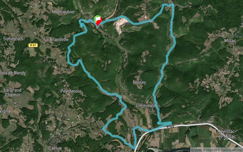


13.9 km
580 m
580 m
 Orliaguet (24)
 Points of Interest table
| Accum. | Intermediary | |||||||
|---|---|---|---|---|---|---|---|---|
| POI | Description | Alt. | Dist. | D+ | D- | Dist. | D+ | D- |
Trace n°112264
Ascent threshold : 3 m Distance threshold : 30 m Smoothing : No Origin of altitudes : MNT Aster GDEM
Ascent threshold : 3 m Distance threshold : 30 m Smoothing : No Origin of altitudes : MNT Aster GDEM
Loop
Dominant terrain : Path
Max alti. : 276 m
Avg alti. : 152 m
Min alti. : 82 m
Longest ascent : 200 m
Longest descent : 160 m
Route completed by the author : No
Dominant terrain : Path
Max alti. : 276 m
Avg alti. : 152 m
Min alti. : 82 m
Longest ascent : 200 m
Longest descent : 160 m
Route completed by the author : No
Elevation profile
More tools
Create a new roadbook page
Map and track on your website
Warning ! When you insert a Trace de Trail map on your website, you agree not to hide any element of the module (links to Trail Trail or Trail Connect banner)
Add a realisation
Validate
Add a realisation to share your chrono and describe the conditions that you encountered during you trail running !
Add a comment
Validate
Franck28
08/06/20, 20:28:27
Ballade sympa, tous les chemins ne sont pas toujours faciles d accès mais on y arrive en cherchant un peu.
08/06/20, 20:28:27
Ballade sympa, tous les chemins ne sont pas toujours faciles d accès mais on y arrive en cherchant un peu.
Show the infos
Add a track


