Flagstones abound
Add to my favorites

Along this circular route around Crémieuin in northern Isère, stone is omnipresent in natural and heritage sites with the medieval town, an archaeological site, the flagstone museum and amazing caves.
The characteristics of the route.

Siccieu-Saint-Julien-et-Carisieu (38)
- Distance 44 km
- Elevation gain 550 m
- Elevation lost 550 m
- Min. elevation 202 m
- Max. elevation. 424 m
- Duration (depending on pace) 2h30
- Marking Yes
Start out from Siccieu-Saint-Julien-et-Carisieu along the D52 to Crémieu, then turn right onto the D65. Pass through Certeau and Leyrieu, then turn right onto the D65E.
Carry on through Vernas and Hières-sur-Amby .
Take direction Optevoz on the RD52A. At the intersection with the RD52I, turn right towards Chatelans, Le Rocher.
Just after Annoisin, turn left towards Siccieu.
When you reach the RD52, turn left towards Optevoz.
At Courtenay, take the RD140 road, then go right and continue via Soleymieu, Carizieu and Siccieu back to the start.
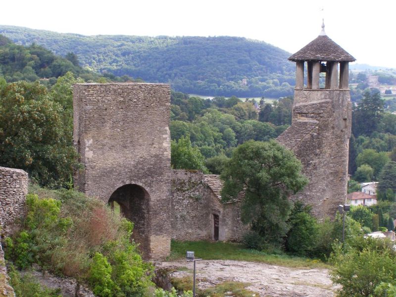
This itinerary in the land of stone takes you from the medieval town of Crémieu, along the cliffs of Larina to admire the rich archaeological heritage of Hières-sur-Amby, before returning via Annoisin-Chatelans on a lane lined with boxwood, blue juniper, and flagstone walls.Good plans : La Foyesse: an original brioche, a speciality found in Crémieu. Use a pound of flour to make a "volcano" and incorporate the following ingredients: 10 g salt 25 g sugar 4 eggs 1/2 cube baker's yeast 1/2 glass lukewarm water Add 300 g of softened butter, knead and leave to stand for an hour and a half. Fold the dough again and leave to rise for another hour and a half. Flatten the dough on a sheet of greaseproof paper, then leave to rise for another hour. Scatter dabs of butter on the dough and sprinkle with white sugar. Bake for 25 minutes. Allow to cool before serving.Admission fee : Free access.Opening : From 01/01 to 31/12. Subject to favorable weather.
Carry on through Vernas and Hières-sur-Amby .
Take direction Optevoz on the RD52A. At the intersection with the RD52I, turn right towards Chatelans, Le Rocher.
Just after Annoisin, turn left towards Siccieu.
When you reach the RD52, turn left towards Optevoz.
At Courtenay, take the RD140 road, then go right and continue via Soleymieu, Carizieu and Siccieu back to the start.
This itinerary in the land of stone takes you from the medieval town of Crémieu, along the cliffs of Larina to admire the rich archaeological heritage of Hières-sur-Amby, before returning via Annoisin-Chatelans on a lane lined with boxwood, blue juniper, and flagstone walls.Good plans : La Foyesse: an original brioche, a speciality found in Crémieu. Use a pound of flour to make a "volcano" and incorporate the following ingredients: 10 g salt 25 g sugar 4 eggs 1/2 cube baker's yeast 1/2 glass lukewarm water Add 300 g of softened butter, knead and leave to stand for an hour and a half. Fold the dough again and leave to rise for another hour and a half. Flatten the dough on a sheet of greaseproof paper, then leave to rise for another hour. Scatter dabs of butter on the dough and sprinkle with white sugar. Bake for 25 minutes. Allow to cool before serving.Admission fee : Free access.Opening : From 01/01 to 31/12. Subject to favorable weather.
Area : Balcons du Dauphiné
Report a problem Add a comment
Features of the application :
- Location and orientation on detailed maps thanks to the GPS of your smartphone
- Description of routes and points of interest on the route
- Photo gallery by route
- Detailed elevation profile
- Route tracking alert to warn you if you stray from the route
- Send predefined messages by SMS to your contacts
- Emergency module: trigger a call or send an emergency SMS in case of problem
- Agenda: access to events organized in the department
- News: find in the application the latest news on the web portal
- Adding achievements
- Add reports in case of problems encountered on the routes
- Share on social networks
Add your time and share your feelings
Services nearby

Etang de Lemps sensitive natural area
Optevoz
Salette Lake
Courtenay

Hières-sur-Amby Heritage Centre
Hières-sur-Amby
Mineralogica - The mineral museum
Villemoirieu
Marais de la Besseye Sensitive Natural Area
Villemoirieu


Information updated on 2022-02-11 by Isère Attractivité


Follow us on
the digital trails
the digital trails


![]()
The Isère Outdoor application was created
by the Département de l'Isère
Infos & contact
Conseil départemental de l'Isère
7 rue Fantin Latour
CS 41096
38 022 Grenoble cedex 1
Tel. 04 76 00 38 38


OK
Annuler