Alpe d'Huez, the mythical climb
Add to my favorites

Caution! Zone of vigilance near the route
Faucon pèlerin - du 01/02/2024 au 30/06/2024 In progress
Aigle royal - du 01/01/2024 au 31/08/2024 In progress

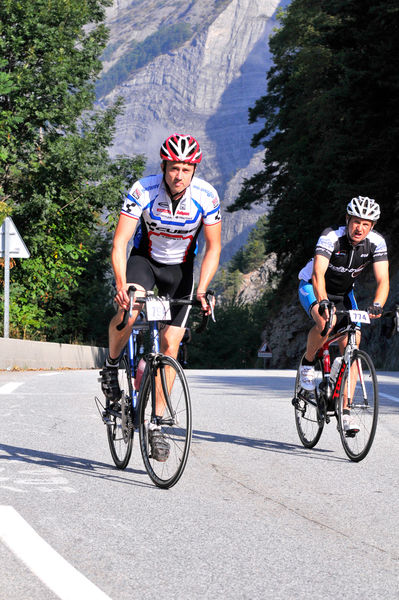
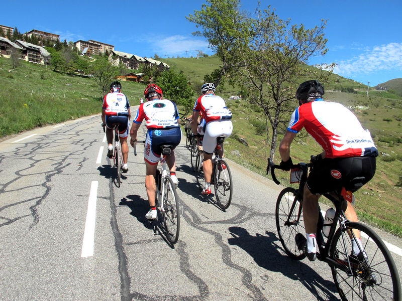
Want to relive the moments of euphoria on this mythical stage of the Tour de France?
From Bourg d'Oisans, the climb has an incline of 7.9% over a total length of 13.8 km. No one has ever beaten Marco Pantani’s impressive record of 37’35’’.
The characteristics of the route.

Le Bourg-d'Oisans (38)
- Distance 30.7 km
- Elevation gain 1160 m
- Elevation lost 1160 m
- Min. elevation 717 m
- Max. elevation. 1842 m
- Duration (depending on pace) 2h
- Marking No
Itinerary no. 4 of the “Cycling in Oisans” guide (Oisans Tourisme)
Departure / Arrival: Bourg d'Oisans 720 m
Time: 2 h
Distance (R/T): 31 km
Highest point: 1850 m
Lowest point: 720 m
Total ascent: 1266 m
Max. gradient: 15%
Map: Michelin Local Map no. 333 Isère, Savoie
ITINERARY
The ride starts in front of the tourist office in Bourg d'Oisans.
From Bourg d’Oisans, follow the road towards Alpe d'Huez. Enjoy pedalling on the flat for a short kilometre before tackling the famous 21 bends.
The first bit is very hard, with 12% gradients for some sections. Make sure you save your energy on those first 2 to 3 kilometres. From Huez, 6 km from the finishing line, it will be easier to impose your rhythm.
When arriving at Alpe d'Huez, follow signs to “Office de Tourisme”, then follow the indications “Itinéraire du Tour de France” until the official arrival at the top of the Rif Nel avenue (above the Étendard roundabout).
THAT LITTLE BIT FURTHER: Lac Besson
You may wish to continue the road up to Lake Besson.
---
Distance (R/T): 8 km
Time: 25 min
Total ascent: 232 m
The Tour de France
The “road up to Alpe”, as it is affectionately called, has become a cyclists’ sanctuary. It is unique and magical for its itinerary and its hairpin bends, each of which has a name and a number, and when the Tour de France passes by, its hillsides are all packed with spectators. On the very day of the Tour, both sides of the road are flanked with crowds along the 14 km ascent. The ride to Alpe d’Huez has become a real legend!Opening : From 01/05 to 15/11. Subject to favorable snow and weather conditions.
Area : Oisans
Report a problem Add a comment
Website Features of the application :
- Location and orientation on detailed maps thanks to the GPS of your smartphone
- Description of routes and points of interest on the route
- Photo gallery by route
- Detailed elevation profile
- Route tracking alert to warn you if you stray from the route
- Send predefined messages by SMS to your contacts
- Emergency module: trigger a call or send an emergency SMS in case of problem
- Agenda: access to events organized in the department
- News: find in the application the latest news on the web portal
- Adding achievements
- Add reports in case of problems encountered on the routes
- Share on social networks
Add your time and share your feelings
Services nearby

Tourist office of Le Bourg-d'Oisans
Le Bourg-d'Oisans

Museum of Minerals and Alpine Wildlife
Le Bourg-d'Oisans
Auris-en-Oisans tourist office
Auris-en-Oisans
Tourist office of Villard-Reculas
Villard-Reculas
Office de Tourisme
Alpe d'Huez


Information updated on 2024-03-18 by Oisans Tourisme


Follow us on
the digital trails
the digital trails


![]()
The Isère Outdoor application was created
by the Département de l'Isère
Infos & contact
Conseil départemental de l'Isère
7 rue Fantin Latour
CS 41096
38 022 Grenoble cedex 1
Tel. 04 76 00 38 38


OK
Annuler