Show the map
Églazines - Cirque de St-Marcellin - Liaucous
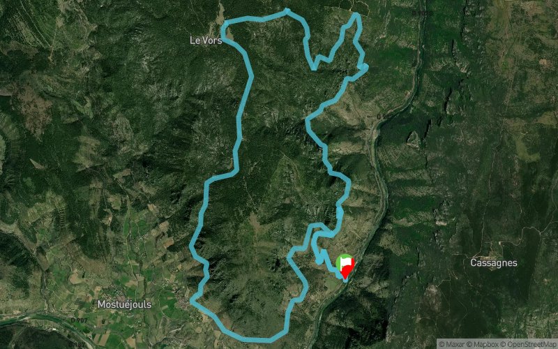


18.3 km
1070 m
1070 m
 Le Rozier (48)
 Points of Interest table
| Accum. | Intermediary | |||||||
|---|---|---|---|---|---|---|---|---|
| POI | Description | Alt. | Dist. | D+ | D- | Dist. | D+ | D- |
Trace n°106602
Ascent threshold : 3 m Distance threshold : 30 m Smoothing : Yes Origin of altitudes : MNT Aster GDEM
Ascent threshold : 3 m Distance threshold : 30 m Smoothing : Yes Origin of altitudes : MNT Aster GDEM
Loop
Dominant terrain : Footpath
Max alti. : 935 m
Avg alti. : 692 m
Min alti. : 402 m
Longest ascent : 290 m
Longest descent : 440 m
Route completed by the author : No
Dominant terrain : Footpath
Max alti. : 935 m
Avg alti. : 692 m
Min alti. : 402 m
Longest ascent : 290 m
Longest descent : 440 m
Route completed by the author : No
Elevation profile
More tools
Create a new roadbook page
Map and track on your website
Warning ! When you insert a Trace de Trail map on your website, you agree not to hide any element of the module (links to Trail Trail or Trail Connect banner)
Add a realisation
Validate
Add a realisation to share your chrono and describe the conditions that you encountered during you trail running !
Add a comment
Validate
Trail-12
21/07/20, 19:33:25
effectivement , mais on le retrouve assez facilement surtout en ayant la trace dans la montre , merci de l'avoir précisé
21/07/20, 19:33:25
effectivement , mais on le retrouve assez facilement surtout en ayant la trace dans la montre , merci de l'avoir précisé
fabieno
21/07/20, 14:53:02
Attention,aux alentours du 13 kms le chemin est barré.j ai pu retrouvé le tracé grâce à une habitante mais le sentier n est plus entretenu .il faut passer par dessus la barrière et suivre le tracé.et à un moment on retrouve le chemin...
21/07/20, 14:53:02
Attention,aux alentours du 13 kms le chemin est barré.j ai pu retrouvé le tracé grâce à une habitante mais le sentier n est plus entretenu .il faut passer par dessus la barrière et suivre le tracé.et à un moment on retrouve le chemin...
Show the infos
Add a track


