Show the map
Certified Track - ITRA
Trail des Fontaines 2020 - TDF 40
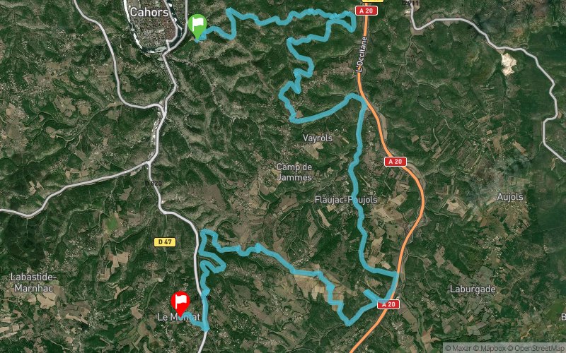


37.5 km
1920 m
1920 m
 Cahors (46)
 Le Montat (46)
 5
5 Points of Interest table
| Accum. | Intermediary | |||||||
|---|---|---|---|---|---|---|---|---|
| POI | Description | Alt. | Dist. | D+ | D- | Dist. | D+ | D- |
 Competition organized on 02/09/2020
Trace n°104913
Ascent threshold : 3 m Distance threshold : 0 m Smoothing : No Origin of altitudes : GPS
Ascent threshold : 3 m Distance threshold : 0 m Smoothing : No Origin of altitudes : GPS
Crossing
Dominant terrain : Footpath
Max alti. : 295 m
Avg alti. : 228 m
Min alti. : 140 m
Longest ascent : 290 m
Longest descent : 230 m
Dominant terrain : Footpath
Max alti. : 295 m
Avg alti. : 228 m
Min alti. : 140 m
Longest ascent : 290 m
Longest descent : 230 m
Elevation profile
More tools
Create a new roadbook page
Map and track on your website
Warning ! When you insert a Trace de Trail map on your website, you agree not to hide any element of the module (links to Trail Trail or Trail Connect banner)
Add a realisation
Validate
Add a realisation to share your chrono and describe the conditions that you encountered during you trail running !
Add a comment
Validate
Show the infos
Warning ! This track is only accessible on the day of the competition.
Add a track


