Show the map
Hautepierre-le-Châtelet - Source de la Loue - Gorges de Nouailles - Rochers du Capucin
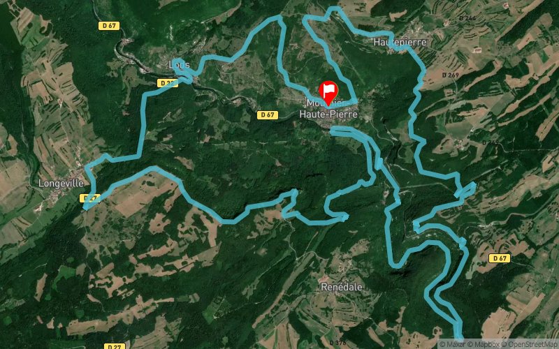


33.7 km
3420 m
3420 m
 Mouthier-Haute-Pierre (25)
 Mouthier-Haute-Pierre (25)
 Points of Interest table
| Accum. | Intermediary | |||||||
|---|---|---|---|---|---|---|---|---|
| POI | Description | Alt. | Dist. | D+ | D- | Dist. | D+ | D- |
Trace n°85537
Ascent threshold : 3 m Distance threshold : 30 m Smoothing : No Origin of altitudes : MNT Aster GDEM
Ascent threshold : 3 m Distance threshold : 30 m Smoothing : No Origin of altitudes : MNT Aster GDEM
Loop
Dominant terrain : Footpath
Max alti. : 866 m
Avg alti. : 615 m
Min alti. : 367 m
Longest ascent : 700 m
Longest descent : 540 m
Route completed by the author : No
Dominant terrain : Footpath
Max alti. : 866 m
Avg alti. : 615 m
Min alti. : 367 m
Longest ascent : 700 m
Longest descent : 540 m
Route completed by the author : No
Elevation profile
More tools
Create a new roadbook page
Map and track on your website
Warning ! When you insert a Trace de Trail map on your website, you agree not to hide any element of the module (links to Trail Trail or Trail Connect banner)
Add a realisation
Validate
Add a realisation to share your chrono and describe the conditions that you encountered during you trail running !
Add a comment
Validate
Lulu Dupré
26/09/21, 12:03:45
Le dénivelé total ne fait que 1575m de d+/d- La qualité de la trace est très mauvaise, presque jamais sur le chemin Je déconseille
26/09/21, 12:03:45
Le dénivelé total ne fait que 1575m de d+/d- La qualité de la trace est très mauvaise, presque jamais sur le chemin Je déconseille
Show the infos
Add a track


