Show the map
Mont Noir - Mont Kokereel - Mont Rouge
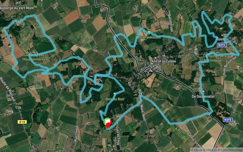


23.7 km
970 m
970 m
 Saint-Jans-Cappel (59)
 Points of Interest table
| Accum. | Intermediary | |||||||
|---|---|---|---|---|---|---|---|---|
| POI | Description | Alt. | Dist. | D+ | D- | Dist. | D+ | D- |
Trace n°66595
Ascent threshold : 3 m Distance threshold : 30 m Smoothing : No Origin of altitudes : MNT Aster GDEM
Ascent threshold : 3 m Distance threshold : 30 m Smoothing : No Origin of altitudes : MNT Aster GDEM
Loop
Dominant terrain : Path
Max alti. : 140 m
Avg alti. : 85 m
Min alti. : 32 m
Longest ascent : 140 m
Longest descent : 100 m
Route completed by the author : No
Dominant terrain : Path
Max alti. : 140 m
Avg alti. : 85 m
Min alti. : 32 m
Longest ascent : 140 m
Longest descent : 100 m
Route completed by the author : No
Elevation profile
More tools
Create a new roadbook page
Map and track on your website
Warning ! When you insert a Trace de Trail map on your website, you agree not to hide any element of the module (links to Trail Trail or Trail Connect banner)
Add a realisation
Validate
Add a realisation to share your chrono and describe the conditions that you encountered during you trail running !
Add a comment
Validate
Charles-Louis Jeanson
26/01/20, 16:03:18
Beau parcours 2 -3 passages difficiles à trouver , peut être plus d’actualité Pas mal de portions bitumés tout de même Dénivelé plutôt 600m
26/01/20, 16:03:18
Beau parcours 2 -3 passages difficiles à trouver , peut être plus d’actualité Pas mal de portions bitumés tout de même Dénivelé plutôt 600m
Admin - Trace de Trail
27/08/18, 14:18:43
Bonjour, Merci de respecter les règles de nommage du site avant de placer votre trace en public : https://tracedetrail.com/fr/accueil/help/alire
27/08/18, 14:18:43
Bonjour, Merci de respecter les règles de nommage du site avant de placer votre trace en public : https://tracedetrail.com/fr/accueil/help/alire
Show the infos
Add a track


