Show the map
Prioron - Fontbonne - Chambaud
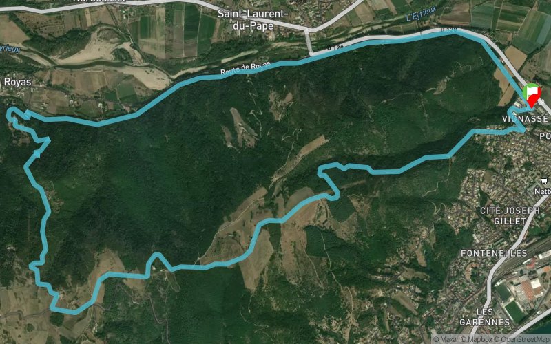


11.7 km
340 m
340 m
 Beauchastel (07)
 Points of Interest table
| Accum. | Intermediary | |||||||
|---|---|---|---|---|---|---|---|---|
| POI | Description | Alt. | Dist. | D+ | D- | Dist. | D+ | D- |
Trace n°61018
Ascent threshold : 3 m Distance threshold : 30 m Smoothing : Yes Origin of altitudes : MNT IGN
Ascent threshold : 3 m Distance threshold : 30 m Smoothing : Yes Origin of altitudes : MNT IGN
Loop
Dominant terrain : Path
Max alti. : 416 m
Avg alti. : 239 m
Min alti. : 110 m
Longest ascent : 340 m
Longest descent : 310 m
Route completed by the author : No
Dominant terrain : Path
Max alti. : 416 m
Avg alti. : 239 m
Min alti. : 110 m
Longest ascent : 340 m
Longest descent : 310 m
Route completed by the author : No
Elevation profile
More tools
Create a new roadbook page
Map and track on your website
Warning ! When you insert a Trace de Trail map on your website, you agree not to hide any element of the module (links to Trail Trail or Trail Connect banner)
Add a realisation
Validate
Add a realisation to share your chrono and describe the conditions that you encountered during you trail running !
Add a comment
Validate
Admin - Trace de Trail
27/01/20, 20:19:23
Bonjour, Pour le dénivelé, la méthode conseillée en France est l'utilisation du MNT IGN. Ce n'était pas le cas pour cette trace...
27/01/20, 20:19:23
Bonjour, Pour le dénivelé, la méthode conseillée en France est l'utilisation du MNT IGN. Ce n'était pas le cas pour cette trace...
Fif43
27/01/20, 20:14:15
Trop de goudron dommage et le dénivelé affiché est incorrect il y a a peine 360d+
27/01/20, 20:14:15
Trop de goudron dommage et le dénivelé affiché est incorrect il y a a peine 360d+
Show the infos
Add a track


