Show the map
Font d'Alagnon - Col de Cabre - Puy de Peyre Arse - Puy de Bataillouse
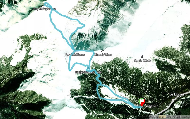


10 km
1070 m
1070 m
 Saint-Jacques-des-Blats (15)
 Points of Interest table
| Accum. | Intermediary | |||||||
|---|---|---|---|---|---|---|---|---|
| POI | Description | Alt. | Dist. | D+ | D- | Dist. | D+ | D- |
Trace n°102564
Ascent threshold : 3 m Distance threshold : 30 m Smoothing : Yes Origin of altitudes : MNT Aster GDEM
Ascent threshold : 3 m Distance threshold : 30 m Smoothing : Yes Origin of altitudes : MNT Aster GDEM
Loop
Dominant terrain : Footpath
Max alti. : 1782 m
Avg alti. : 1433 m
Min alti. : 1196 m
Longest ascent : 460 m
Longest descent : 480 m
Route completed by the author : No
Dominant terrain : Footpath
Max alti. : 1782 m
Avg alti. : 1433 m
Min alti. : 1196 m
Longest ascent : 460 m
Longest descent : 480 m
Route completed by the author : No
Elevation profile
More tools
Create a new roadbook page
Map and track on your website
Warning ! When you insert a Trace de Trail map on your website, you agree not to hide any element of the module (links to Trail Trail or Trail Connect banner)
Add a realisation
Validate
Add a realisation to share your chrono and describe the conditions that you encountered during you trail running !
Add a comment
Validate
Manu1076
09/08/20, 22:03:51
Trace très dangereuse...on descend de Peyre Arse droit ds la végétation...et certains sentiers n'existent plus...je déconseille vivement...
09/08/20, 22:03:51
Trace très dangereuse...on descend de Peyre Arse droit ds la végétation...et certains sentiers n'existent plus...je déconseille vivement...
Show the infos
Add a track


