Show the map
Pierre Rouge - Pointe de Chavasse - Vésinaz


 Mieussy (74)
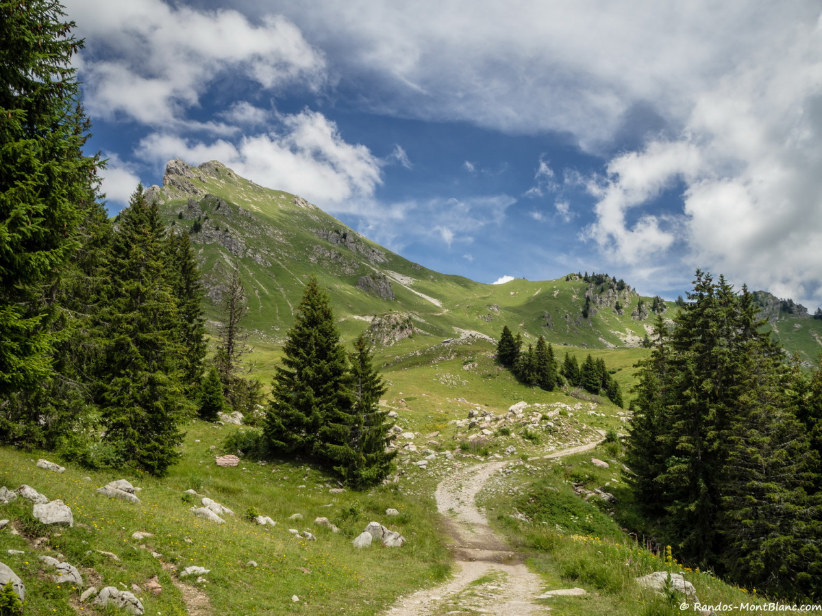
Pointe de Chavasse is a summit of Chablais dominating Praz-de-Lys Sommand. Its toponym, whose origin remains similar to that of the Pointe de la Chavache near Montriond, refers to a summit invaded by undesirable plants. The ascent of Pointe de Chavasse is easy and does not involve any particular difficulty, except for a very short passage on a ridge that can certainly impress, but under no circumstances be an obstacle, even for people with a fear of heights. In the beginning, the climb in the alpine pastures of Chavasse is enjoyable and the meeting with the marmots and ibex quite frequent. From the Col de Vésinaz, the trail to reach the summit of Chavasse becomes steeper and narrower. The views of the Marcelly, the Haute Pointe and of course the Mont-Blanc range are splendid. Note that the route is the same in its first part with that of Pointe de Chalune.
Points of Interest table
| Accum. | Intermediary | |||||||
|---|---|---|---|---|---|---|---|---|
| POI | Description | Alt. | Dist. | D+ | D- | Dist. | D+ | D- |
Trace n°41632
Ascent threshold : 10 m Distance threshold : 30 m Smoothing : Yes Origin of altitudes : MNT Aster GDEM
Ascent threshold : 10 m Distance threshold : 30 m Smoothing : Yes Origin of altitudes : MNT Aster GDEM
Loop
Dominant terrain : Path
Max alti. : 1985 m
Avg alti. : 1719 m
Min alti. : 1539 m
Longest ascent : 420 m
Longest descent : 420 m
Route completed by the author : nc
Dominant terrain : Path
Max alti. : 1985 m
Avg alti. : 1719 m
Min alti. : 1539 m
Longest ascent : 420 m
Longest descent : 420 m
Route completed by the author : nc
Elevation profile
More tools
Create a new roadbook page
Map and track on your website
Warning ! When you insert a Trace de Trail map on your website, you agree not to hide any element of the module (links to Trail Trail or Trail Connect banner)
Add a realisation
Validate
Add a realisation to share your chrono and describe the conditions that you encountered during you trail running !
Add a comment
Validate
Show the infos
Add a track


