Show the map
Ramaz - Col de Chavan - Haute Pointe


 Mieussy (74)
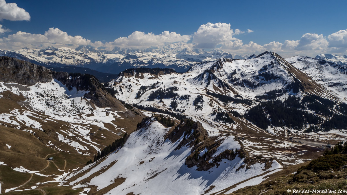
Must-see for the regulars of the resort of Sommand, the Haute Pointe is a walk readily available by a trail that goes up the mountain pastures of Sommand and gives the hiker the opportunity to discover a very broad number of peaks of Haute-Savoie. On the menu, a view of Pointe de la Gay, Dent d’Oche, Roc d’enfer, Pointe de Chalune, the Mont Blanc Massif, the Môle, Brasses and the Salève.
Note that the itinerary is also feasible in winter with snowshoes; this pathway is very similar to the path taken in the summer, except that one can cut and take a more direct trace towards the Col de Chavan that the less courageous or less trained will be able to define as an objective as the panorama there is already superb.
Beware, however, of snow conditions on slopes exposed to avalanches.
Points of Interest table
| Accum. | Intermediary | |||||||
|---|---|---|---|---|---|---|---|---|
| POI | Description | Alt. | Dist. | D+ | D- | Dist. | D+ | D- |
Trace n°35883
Ascent threshold : 10 m Distance threshold : 30 m Smoothing : Yes Origin of altitudes : MNT Aster GDEM
Ascent threshold : 10 m Distance threshold : 30 m Smoothing : Yes Origin of altitudes : MNT Aster GDEM
Loop
Dominant terrain : Path
Max alti. : 1869 m
Avg alti. : 1655 m
Min alti. : 1506 m
Longest ascent : 360 m
Longest descent : 350 m
Route completed by the author : nc
Dominant terrain : Path
Max alti. : 1869 m
Avg alti. : 1655 m
Min alti. : 1506 m
Longest ascent : 360 m
Longest descent : 350 m
Route completed by the author : nc
Elevation profile
More tools
Create a new roadbook page
Map and track on your website
Warning ! When you insert a Trace de Trail map on your website, you agree not to hide any element of the module (links to Trail Trail or Trail Connect banner)
Add a realisation
Validate
Add a realisation to share your chrono and describe the conditions that you encountered during you trail running !
Add a comment
Validate
Show the infos
Add a track


