Show the map
OFFICIAL ROUTE
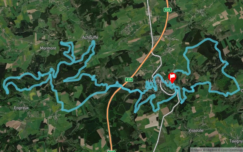
Houffatrail 2020 - 52 km


51.7 km
1720 m
1720 m
 Houffalize (BE)
 Houffalize (BE)
 3
3 320
320 Points of Interest table
| Accum. | Intermediary | |||||||
|---|---|---|---|---|---|---|---|---|
| POI | Description | Alt. | Dist. | D+ | D- | Dist. | D+ | D- |
 Competition organized on 01/28/2018
Trace n°27498
Ascent threshold : 3 m Distance threshold : 30 m Smoothing : Yes Origin of altitudes : MNT Google
Ascent threshold : 3 m Distance threshold : 30 m Smoothing : Yes Origin of altitudes : MNT Google
Loop
Dominant terrain : Footpath
Max alti. : 461 m
Avg alti. : 371 m
Min alti. : 279 m
Longest ascent : 150 m
Longest descent : 140 m
Dominant terrain : Footpath
Max alti. : 461 m
Avg alti. : 371 m
Min alti. : 279 m
Longest ascent : 150 m
Longest descent : 140 m
More tools
Create a new roadbook page
Map and track on your website
Warning ! When you insert a Trace de Trail map on your website, you agree not to hide any element of the module (links to Trail Trail or Trail Connect banner)
Add a realisation
Validate
Add a realisation to share your chrono and describe the conditions that you encountered during you trail running !
Add a comment
Validate
Admin - Trace de Trail
31/05/19, 23:01:02
Bonjour, merci de modifier la date de compétition pour l'édition 2020.
31/05/19, 23:01:02
Bonjour, merci de modifier la date de compétition pour l'édition 2020.
Show the infos
Add a track


