Show the map
Certified Track - ITRA
Gorce Ultra-Trail® 2017 - 102 km


 Ochotnica Dolna (PL)
 Ochotnica Górna (PL)


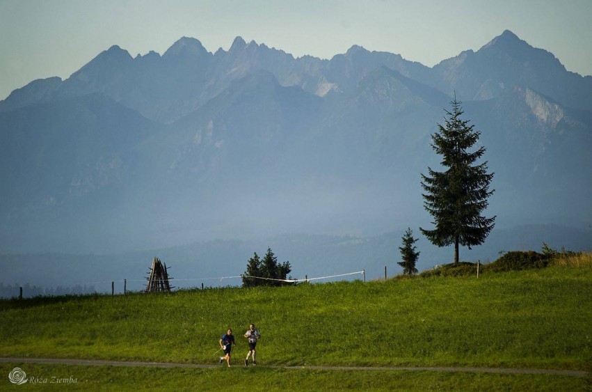
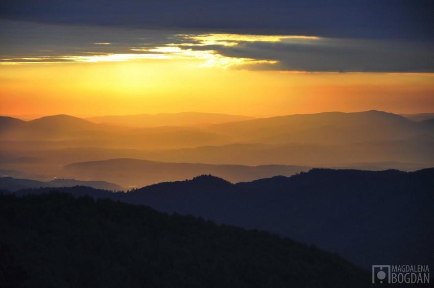
Welcame to Gorce Ultra-Trail® – a run through the most beautiful parts of Gorce Mountains … and the highest peak of Beskid Wyspowy – Mogielica. In the second edition we will have five distances and three days of competition. We start on Friday evening with a short but demanding, Studzionki Vertical. We run all the time up to the place where the sunset is the most beautiful, especially that illuminates the red slopes of the Tatra Mountains. On Saturday two traditional distances of 80 and 43 km, and for those who like the three-digit number – Gorce Ultra-Trail at 102 km. Of course, with 5 new ITRA points. We will end on Sunday, with 20-kilometer Ochotnica Challenge.
Place: Gorce Mountains are situated in the south part of Poland, almost exactly in a half way from Kraków to Zakopane. The highest point – Turbacz – is 1310 m a.s.l. The range is cover with a coniferous forest but there is plenty of mountain pasture as well.
Points of Interest table
| Accum. | Intermediary | |||||||
|---|---|---|---|---|---|---|---|---|
| POI | Description | Alt. | Dist. | D+ | D- | Dist. | D+ | D- |
 Competition organized on 08/12/2017
Trace n°26878
Ascent threshold : 10 m Distance threshold : 0 m Smoothing : No Origin of altitudes : GPS
Ascent threshold : 10 m Distance threshold : 0 m Smoothing : No Origin of altitudes : GPS
Crossing
Dominant terrain : Footpath
Max alti. : 1297 m
Avg alti. : 955 m
Min alti. : 403 m
Longest ascent : 880 m
Longest descent : 410 m
Dominant terrain : Footpath
Max alti. : 1297 m
Avg alti. : 955 m
Min alti. : 403 m
Longest ascent : 880 m
Longest descent : 410 m
Elevation profile
More tools
Create a new roadbook page
Map and track on your website
Warning ! When you insert a Trace de Trail map on your website, you agree not to hide any element of the module (links to Trail Trail or Trail Connect banner)
Add a realisation
Validate
Add a realisation to share your chrono and describe the conditions that you encountered during you trail running !
Add a comment
Validate
Show the infos
Add a track


